


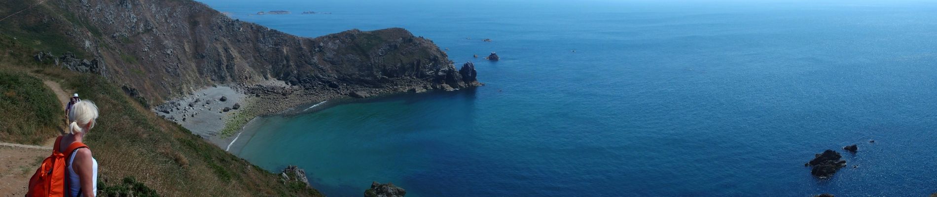
NEZ JOBOURG

TOULAUDIN
User
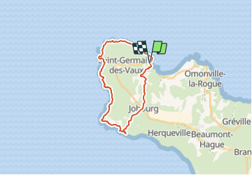

Length
21 km

Max alt
172 m

Uphill gradient
438 m
Km-Effort
27 km

Min alt
0 m

Downhill gradient
444 m
Boucle
Yes
Creation date :
2015-03-10 00:00:00.0
Updated on :
2021-07-22 10:24:43.532
5h48
Difficulty : Difficult

FREE GPS app for hiking
 SityTrail
IGN / Geographical institutes
SityTrail Plus
The world is yours!
About
Trail Walking of 21 km to be discovered at Normandy, Manche, La Hague. This trail is proposed by TOULAUDIN.
Description
splendide rando au départ de Port Racine effectuée par grand beau temps en juillet 2014
Photos


Positioning
Country:
France
Region :
Normandy
Department/Province :
Manche
Municipality :
La Hague
Location:
Saint-Germain-des-Vaux
Start:(Dec)
Start:(UTM)
579459 ; 5507243 (30U) N.
Comments
je suggère de partir par le jardin de Prévert et de terminer par la côte. Que du plaisir pour la beauté des nez et de cette rando. Audier.
Une trésor belle balade même sous le vent et la pluie comme ce jour de septembre. Nous avons cependant zapper par prudence la partie escarpée après l'auberge des grottes qui nous a fait du feu pour sécher un peu nos vêtements.